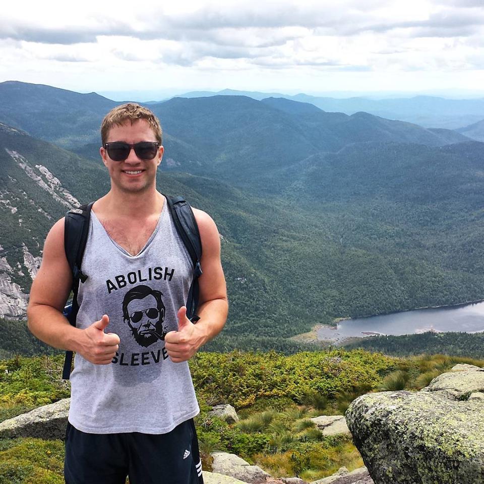
I’ve been doing great this summer with actually doing the things I say I’m going to do. Case in point: I managed to finally make it up to Lake Placid during the summer, which I’ve been threatening since going up there for the first time four years ago.

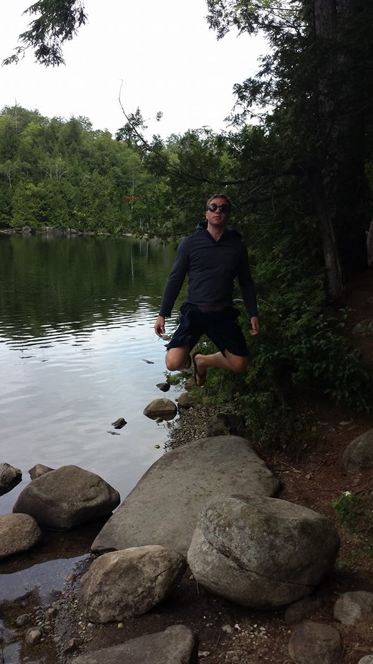
I had a weekend off this past August, and miraculously had nothing planned. After roadtripping to Maine, a weekend in Sea Isle City, boozing through Lancaster, and a few Saturday day drinking sessions with friends, I was ready for a weekend that didn’t revolve around binge drinking, bbqs, and fried seafood. I wanted to do something good for me (ie: my waistline). A quick trip up to Lake Placid hike one of the high peaks was what I envisioned. My brother moved home the week before, and was keen to join me, having missed our last two Placid winter trips. Without too much planning (I’m doing this a lot lately-don’t worry-I’ve got more than one carefully constructed itinerary in the works), I booked a $25.00 a night campsite (we weren’t looking to drop a ton of money, especially after doing so much all July) and decided that if we were going to go for this, we might as well go big, and picked Algonquin Peak, New York’s second tallest mountain, as our hike (I initially was considering the tallest, Mt. Marcy, but all reports seem to indicate that it’s a 7-10 hour hike, which neither of us really felt prepared for).
While the Adirondacks are a little bit of a hike from PA, it’s an easy ride (81 to Binghamton, 88 to Albany, and then 87 to the high peaks wilderness area). We woke up bright and early at 4:30 Saturday morning and were on the road by 5. Our goal was be parked and ready to start hiking between 10:30 and 11:00.

The trailhead for Algonquin Peak is located at the end of Adirondack Loj road, just outside the town of Lake Placid. Typically you must pay a small fee to park at the “loj”, an exceedingly popular place since it contains the the trailheads for Mt. Marcy, Iroquois, Marshall and Wright peaks, along with Algonquin. People hiking in the Adirondacks typically get started early, as many of the hikes are between 3-8 hour affairs, and we noticed while coming down route 73 through Keene Valley that the sides of the road were swarmed with the cars of fellow hikers. Adirondack Loj was no exception. The parking lot was full and we were forced to park about a half mile down the road. We had to walk a bit further, but didn’t have to pay the $10.00 parking fee. I chocked it up to a win.

Because of their popularity, most of the Adirondack high peaks are marked well. Although an employee at the loj suggested we purchase a map, we were entirely fine without one. Now, if it wasn’t a Saturday, and we were trying to hit several peaks in a day, a map probably would have been pertinent, but for our intents and purposes (not intensive purposes), we were fine.
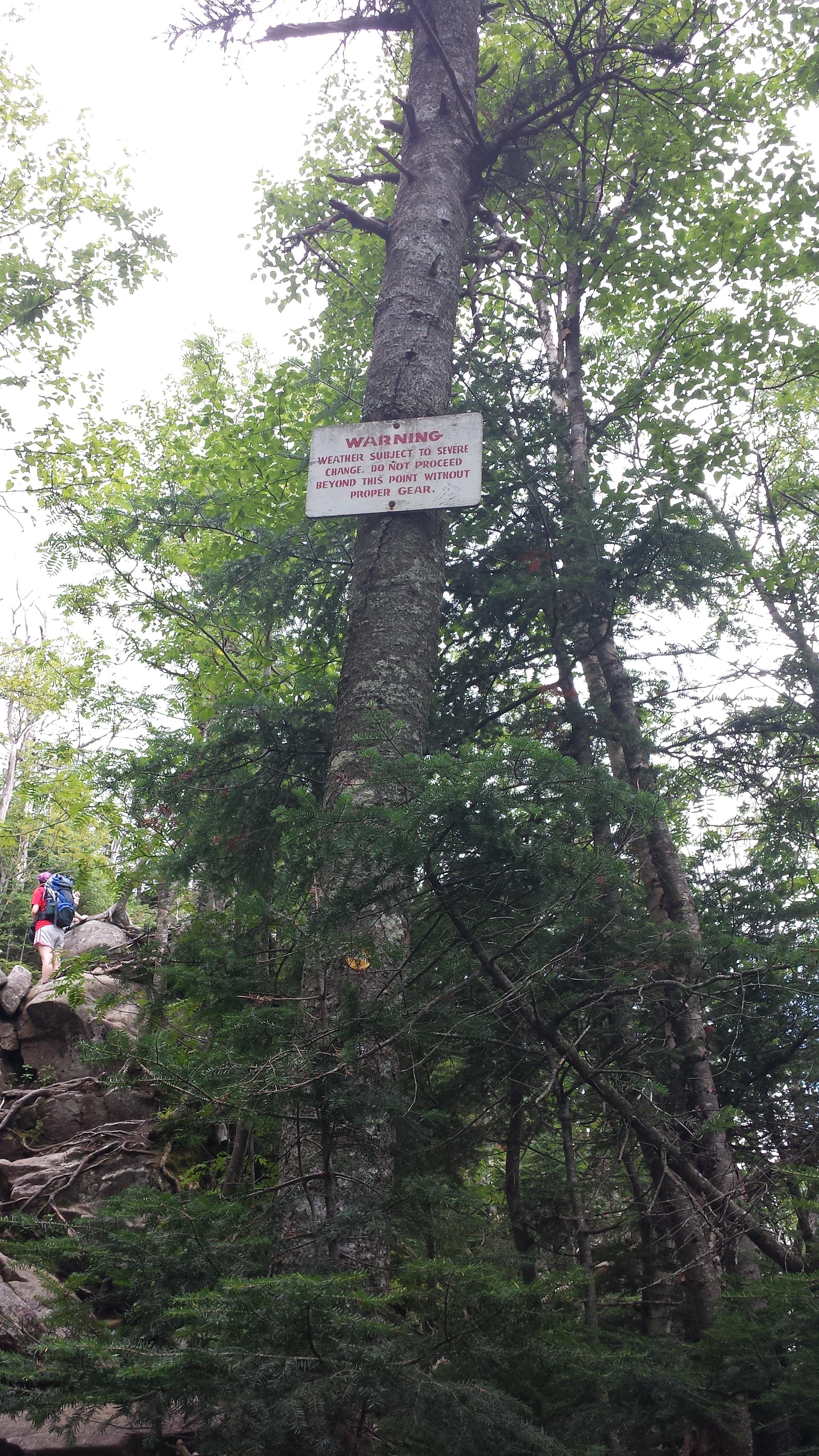
While there’s plenty of hikes in the Adirondacks that could be filed under “fun for the whole family,” Algonquin is not one of them (the hike I did this past March, Cascade, probably is). Algonquin sits at 5,114 feet high, and is a 8 mile roundtrip hike. The first mile is a pleasant enough jaunt on the Marcy Dam trail, meandering through some Adirondack wetlands, and tricks you into thinking you’ve got everything under control. When the trail splits, and you see “Algonquin Peak, 3 miles”, you think to yourself, “I run 3 miles 2-3 times a week. Piece of cake.” You don’t take into account that you’re dealing with a very steep upward climb, or that most of the trail is rocky and you have to carefully figure out where to step, or that a majority of the trail lies in stream beds (we were lucky to have climbed on a nice day-I can’t imagine doing this in/after any sort of rain).

After a particularly grueling set of rock chutes, you reach another fork in the trail. You have a choice here. .3 miles to the top of Iroquois Peak. .9 to the top of Algonquin. The family in front of us were smart. They choice .3 miles. Since we came to conquer Algonquin though, we kept on that path, despite being wiped out and drenched through with sweat (serious aside: how do so many people on these hikes look like they stepped out of an L.L Bean catalog? I was 100% the only person I saw hiking in a disgusting, sweat stained tank top.)

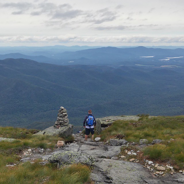
This was hands down the hardest part of the hike. It was also the point were we started to be rewarded with awesome views. What I liked about Algonquin, was that once you reached the point above the treeline, you were well aware of just how high you were, however, there was never any time when I felt afraid. I hate to use the term awe inspiring, but it fits here.
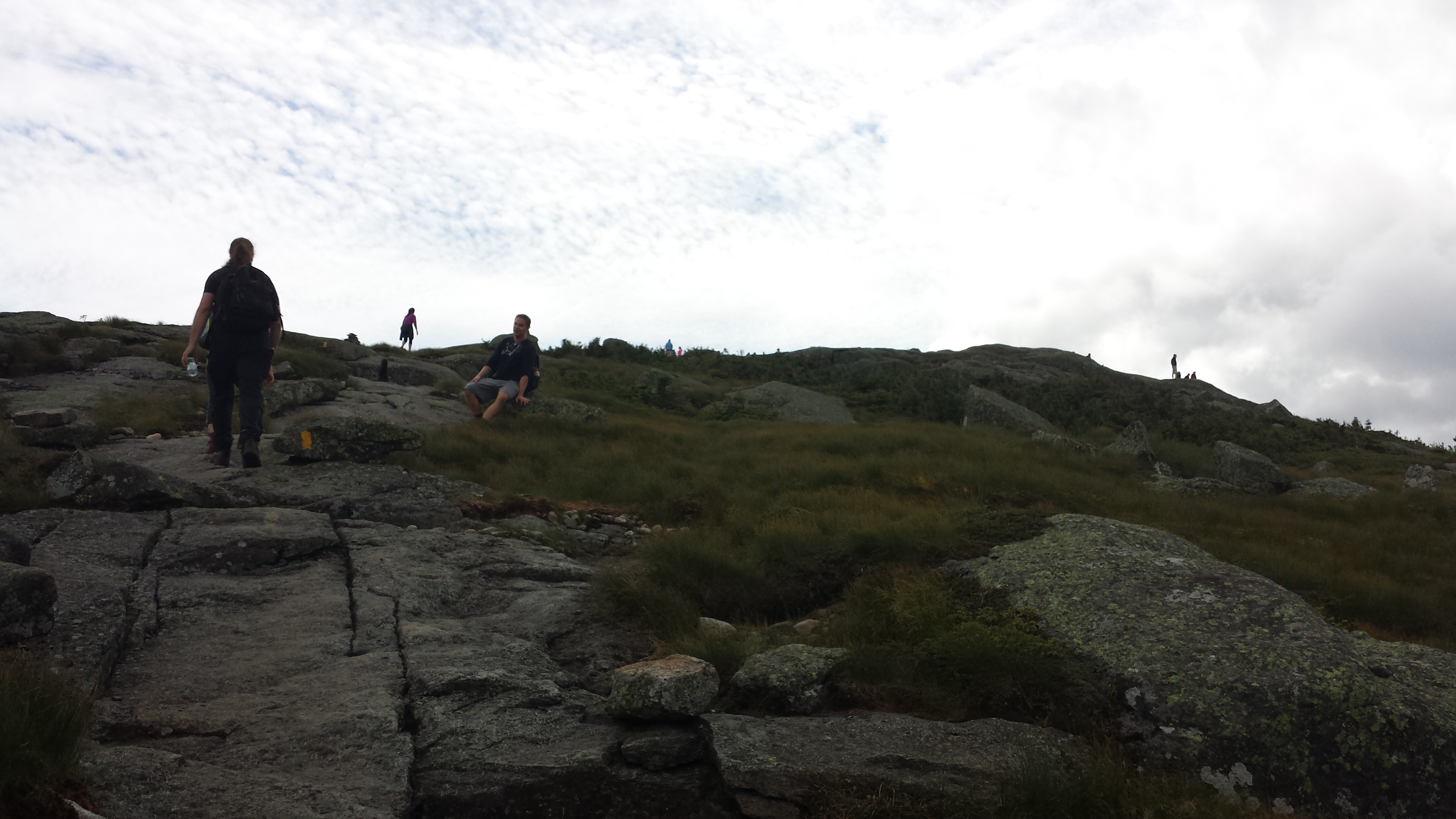

Algonquin Peak, with it’s summit above the treeline, is considered an alpine zone, and because of the amount of hikers, you have to stay in the carefully marked trails, and not walk around in the vegetation. The summit itself is huge, and I wish I took a picture of the sheer amount of people up there. We were able to find a spot a little bit set away from the crowds, and celebrated our victory with half a hoagie (we’d stopped to eat the first half about an hour into the hike), and a Shiner Ruby Red each (fine, I had two).


We didn’t stay on the top for too long, as we both starting getting cold. It had taken us about 3 hours to get to the top, and we did about 2.5 on our way down. Once we got to the bottom, I decided that saving the $10.00 parking fee was absolutely not worth the extra half mile to our car. That last shuffle (it was most definitely not a walk) was hell.
We booked a campsite at Whispering Pines Campground (their website is allegedly coming soon-the link there takes you to the LP website if you want their location and contact info)a small, bare bones campsite about a mile away from the Adirondack Loj road, just across the street from Cascade XC Ski Center. The girl who checked us in was super friendly. She explained how the campsite had just opened on July 20th, so apologize for not being able to take debit cards. I assured her that wasn’t a problem. The campsite also had lean tos and cabins to rent, and she explained how they wanted to winterize the cabins for snow sports, which sounds awesome. I always like talking to people who seem genuinely excited to be running their business.
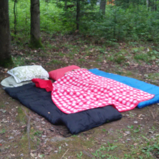
I initially tried to upgrade to a cabin, as we both felt too tired to put up the tent. They unfortunately didn’t have one open, which was fine, because guess what? I forgot the tent! It really wasn’t a problem. We ended up sleeping on the ground under the stars, which turned out perfectly fine, especially for how dead we were once we hit the hay. We laid down our sleeping bags, showered (they have coin operated showers-but the water pressure was the best of any campsite I’ve ever been to), and headed into Lake Placid itself to get some food and beverages.
After a quick stop at the Lake Placid Brewery (which has Adirondack chairs, firepits, and cornhole out overlooking the lake), we decided to take a detour to nearby Saranac Lake to see what it had to offer.
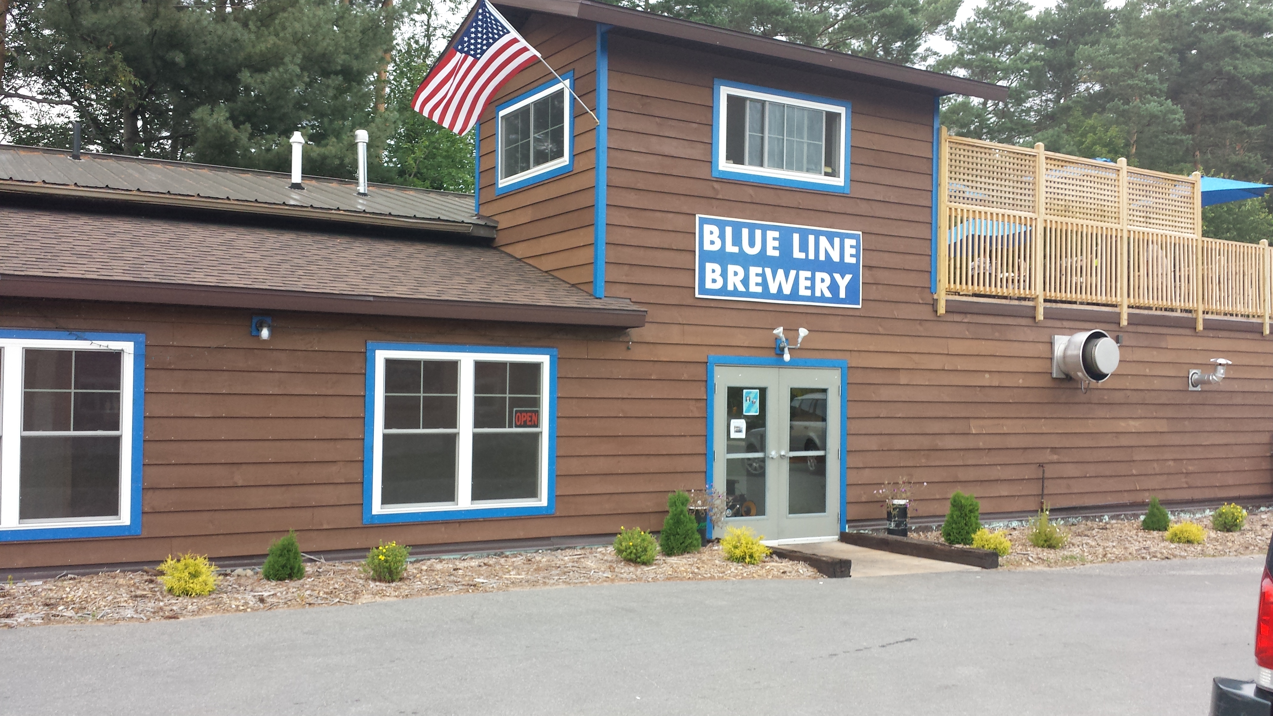
Our first stop the the Blue Line Brewery, located in the same parking lot as a carwash on the outskirts of Saranac Lake. I didn’t dislike this place, and don’t want to begrudge it too much (their food could’ve been delicious and they did serve Yuengling, so score one for PA), but I think it demonstrated a bit why there may be too much of an influx in breweries: the beer was just all ok, and mostly forgettable.
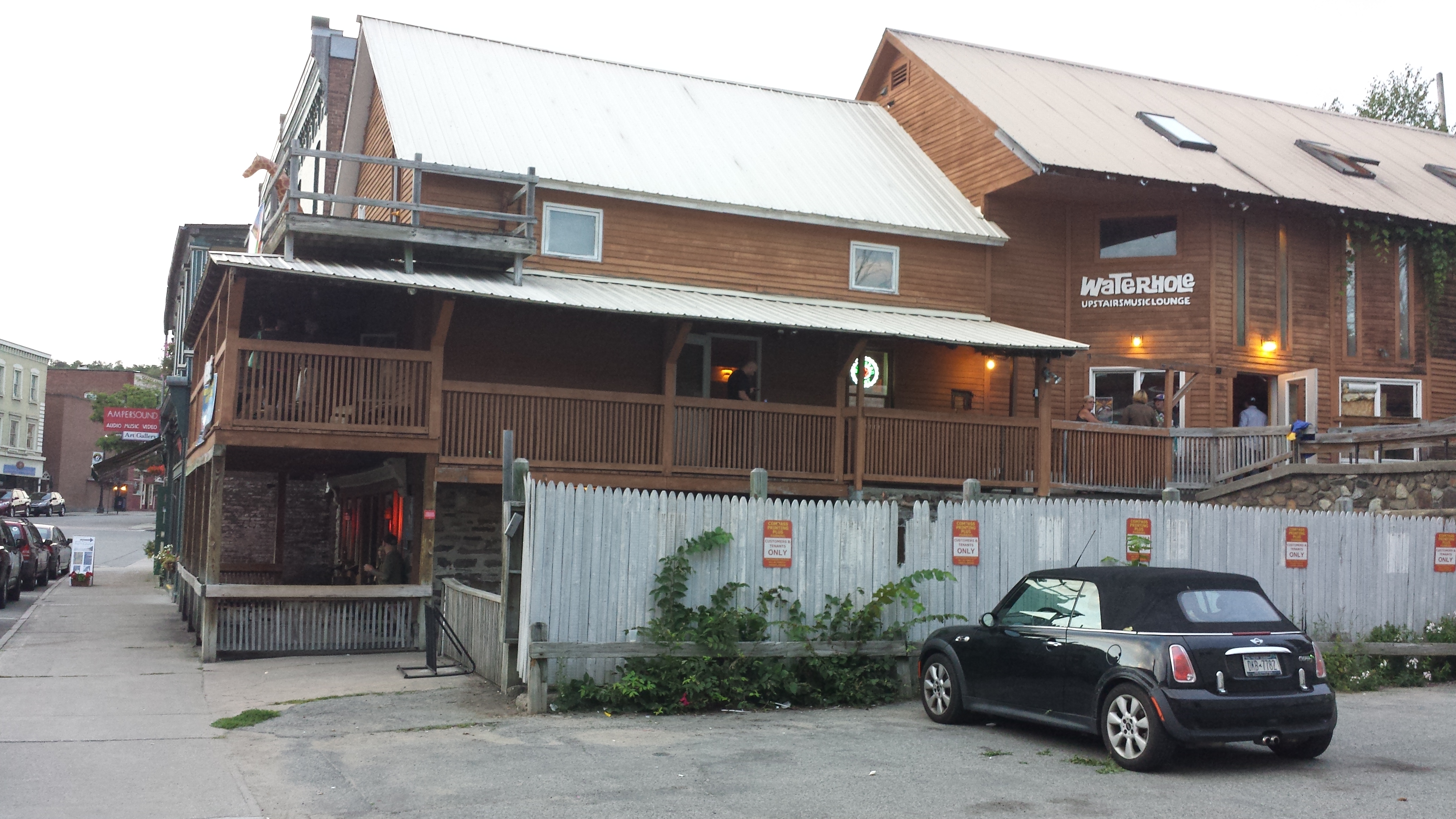
In fact, I regret to say that I wasn’t enthralled with Saranac Lake in general. Maybe it just seemed dead compared to bustling Lake Placid, or maybe it just was dead, but it didn’t feel fun. It felt like it was over it. We stopped at two additional bars, the first, The Rusty Nail, I’m convinced would’ve been a goldmine had we stayed later (you could tell they had the sort of clientele who doesn’t get up till 5 or 6) and the other Water Hole #3 seemed like a decent enough place, but was dead downstairs, where we were. They had a lively upstairs, where apparently the men’s US bobsled team was having some sort of a fundraiser, but a $10.00 cover didn’t seem worth the one or two beers we’d be having.

We returned to Lake Placid, got a slice of pizza, and then went to Players Bar and Grill, one of the only bars with deck seating overlooking the lake. We weren’t planning on eating, but had drank just enough that when the waitress told us about their special small plated kangaroo, we thought it was a great idea. You know what I learned? Kangaroo is actually delicious. What I also learned (or should I say, was vindicated in) is that small plates, for me at least, are ridiculous. It was literally four bites. I at minimum need a grossly oversized burger with at least one side.

We ended our night at my beloved Zig Zags. Regrettably, I did not get a picture in the bobsled. Thankfully, I’m now the owner of a Zig Zags pint glass. Next time I’m upgrading to a tee shirt.

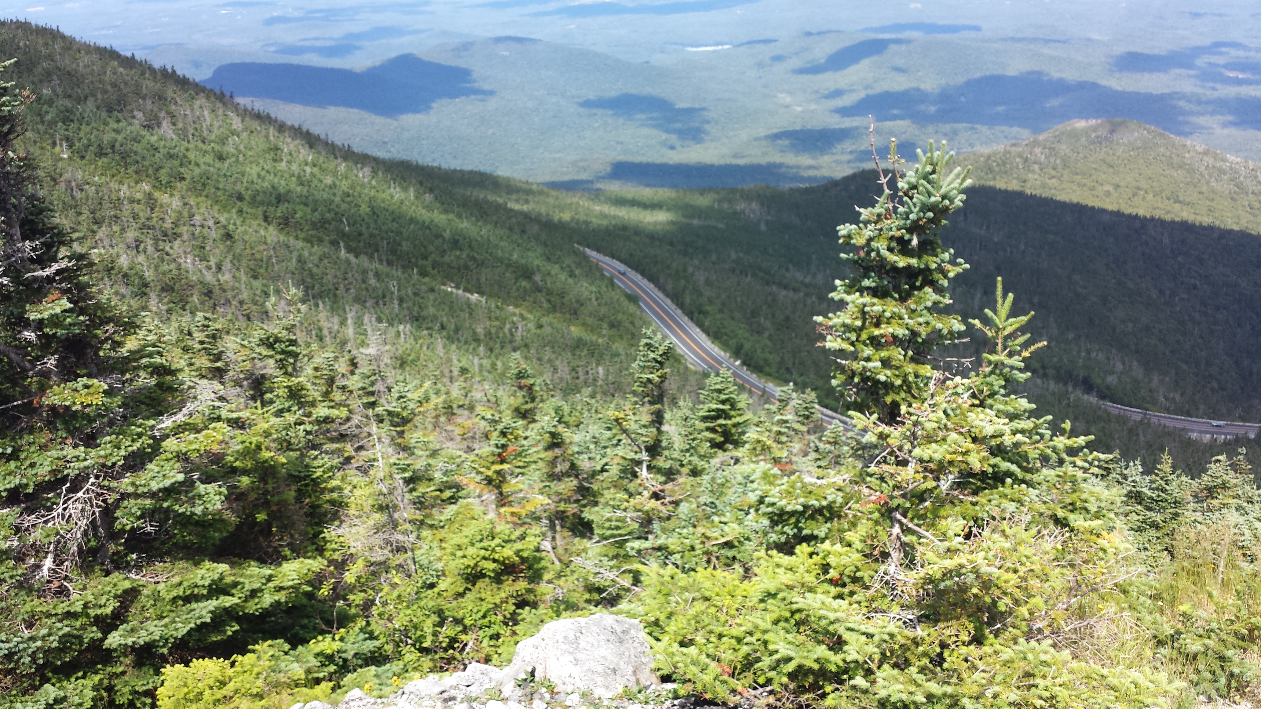
After a solid sleep on the forest floor, I woke up around 10, ran into town to get breakfast (my brother opted for an extra hour’s shut eye), we packed up, and drove to the nearby town of Wilmington with the intent of driving up the Veteran’s Memorial Highway to the top of Whiteface Mountain.
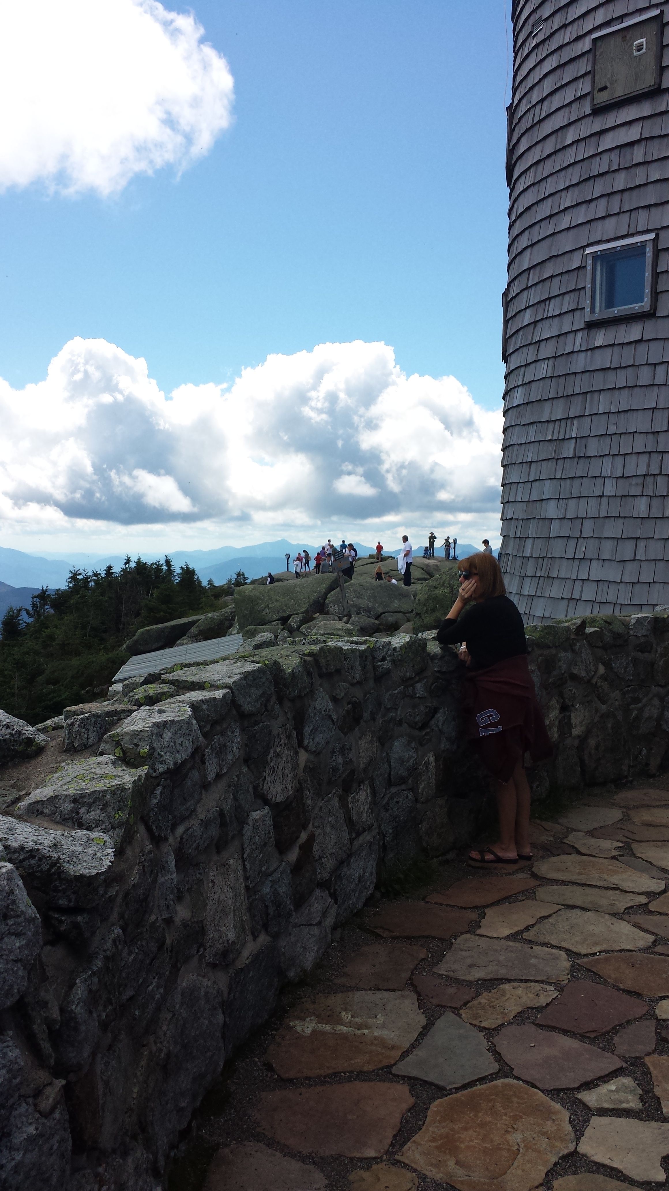
At 4,867, Whiteface is the 5th tallest high peak, the only one you can drive to the top of, and primarily known as a ski resort. The Veteran’s Memorial Highway has been in use since 1935, and takes you close to the top of the mountain for a small fee.
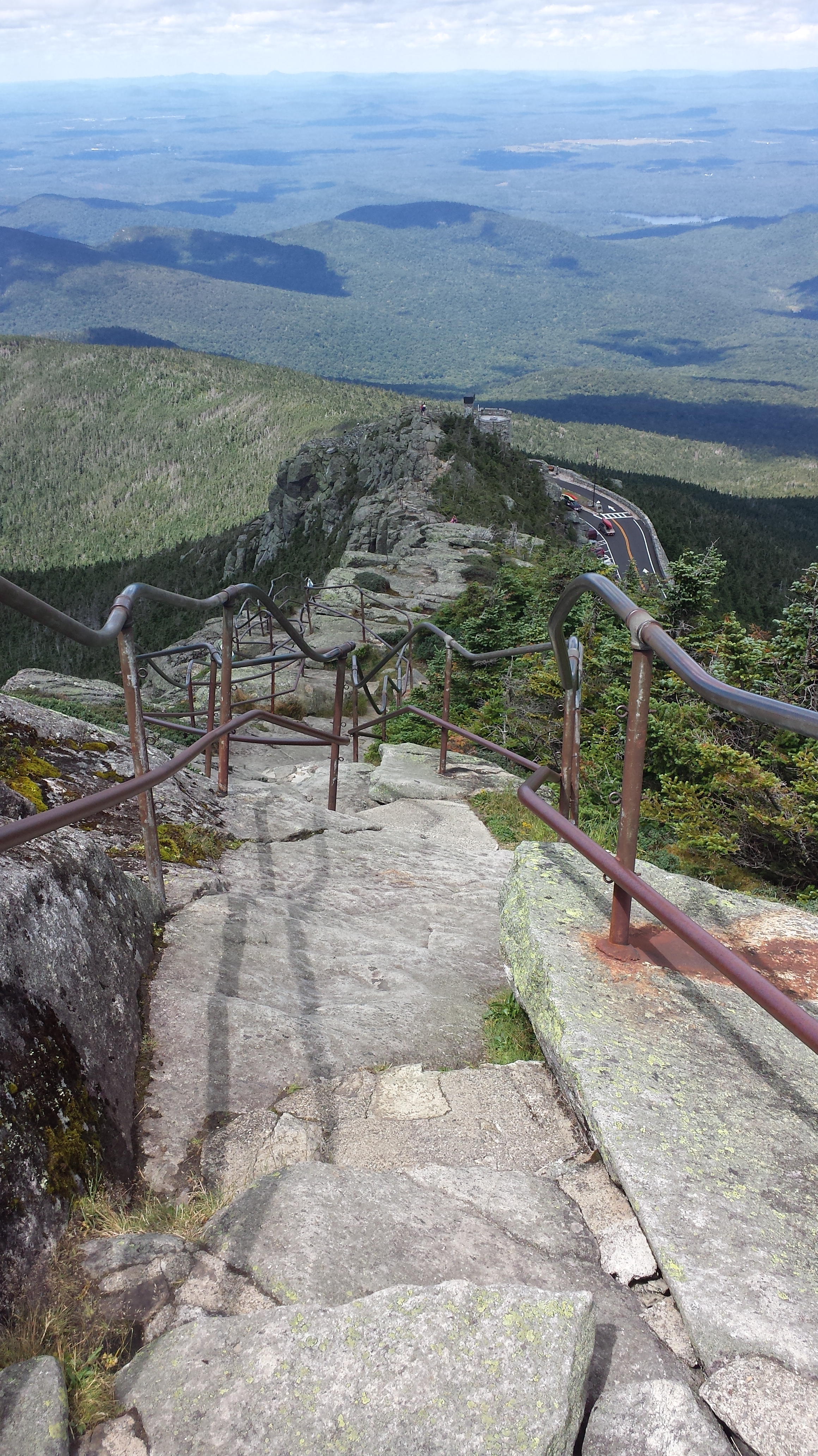
At this point you have two options to reach the actual summit, a .2 miles staircase known as Stairway Ridge Trail, and a tunnel dug into the core of the mountain that brings you to an elevator, that will run you up 27 stories to the very top. Still hurting from Saturday, we obviously took the elevator.
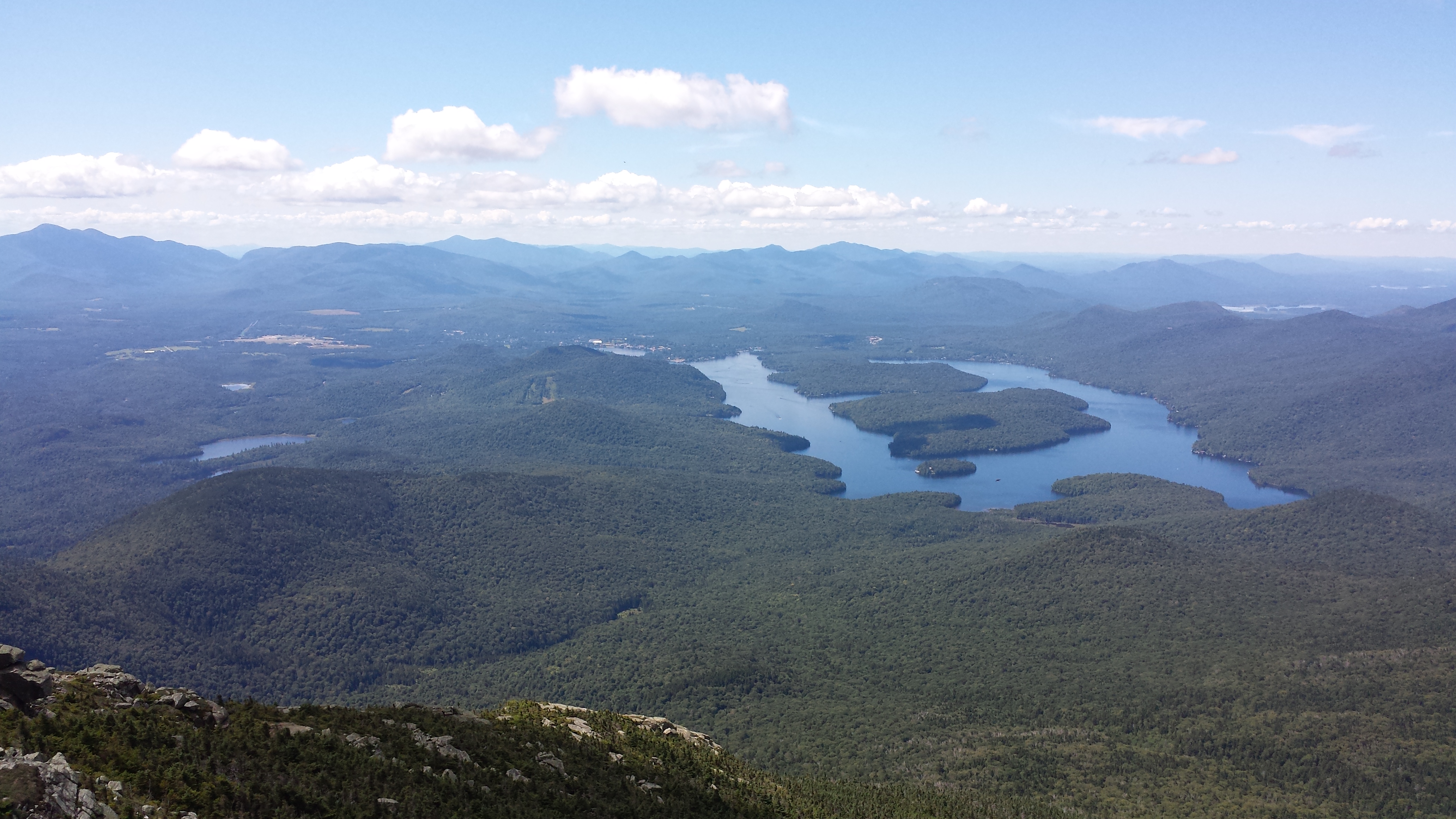
Two things I loved about Whiteface’s summit. The first is obviously the view. It was amazing. Because Whiteface is not really in a range with any other mountains, it has a 360 degree unobstructed view of the entire Adirondack Region, Vermont, and I heard a ranger telling another visitor that if you used the viewfinders you could see Montreal (second aside: has anyone actually ever paid to use a viewfinder anywhere?). The second thing I loved was that Whiteface summit was filled with other people terrified of heights. Usually I’m the only freaking out and looking like I want to shit myself, despite being assured anytime I read about it, that many people are scared of heights. A man in the elevator was freaking out quietly to his wife the entire time, a young father at the top would not venture out past the railing with his children, and an older father with adult children scolded them for getting too near “the edge” when they were no where close. It felt good to finally see others exhibit the crazy behavior heights often drives me to.

After Whiteface, we considered going SUPing on Mirror Lake, but Shawn said he didn’t have it in him. so we decided to head out, stopping briefly at a farmer’s market in Keene Valley so that I could grab some local maple syrup, and some pumpkin butter, because I’m a basic bitch at heart and excited about #allthingspumpkin. We tried to stop at Lake George for lunch, but that place is a cluster*$&@ if I’ve ever seen one, so opted for a healthy lunch at Burger King instead.

All in all it was a great little trip, and after conquering two, I think I officially want to try for the whole 46. Hopefully another free little weekend crops up this fall. I’m thinking maybe doing Porter, Big Slide, or Giant. Any suggestions?
If you’re interested in starting to tackle the high peaks yourself, the Lake Placid website has a comprehensive list of all the hikes and the best ways to conquer them-I highly recommend you check it out.

I enjoyed reading about your adventure. Your post caught my eye because I was just there three weeks ago and I hiked my first two high peaks, Cascade and Porter Mt. I published my posts yesterday. http://www.yvonnestravel.com/?p=4490
I love the area. It gives me the feel of the West and national parks.
You are funny. I have a 21 years old son and I thought that I saw everything but you beat it with forgetting your tent! I also noticed that you use debit card. Unless you have a spending problem, using debit cards of cash is practically throwing money away. I dedicated one post in my blog to this subject. You might want to check it out http://www.yvonnestravel.com/?p=2977 Keep hiking!
I did Cascade this past winter via snowshoe, but couldn’t get all the way to the top, as it was too windy. I’m going to have to try again in nicer weather.
I can’t even imagine snowshoeing there. I do not remember any flat ground there. I do not think even a heavy snowfall would make it doable. In winter I prefer a cozy fire and a drink!
One more thing, Whispering Pine Campground is very familiar. This is where a bunch of raccoons stole our bag full of food. It was not a plastic grocery bag but a solid one with a zipper, rather heavy. It was a few them of criminals working in full cooperation.