
For the past half year or so I’ve been questioning my career, my trajectory, and many of my major life choices. I’m 27, not completely sure what I want to do with life, where I want to end up, and wonder if I should ease up with the all night drinking and traveling and carrying on when I don’t feel remotely ready to ease up on the all night drinking and traveling and carrying on. So I just did a little googling and am glad to see that a mid-20’s crisis, or a quarter life crisis as Wikipedia so aptly puts it, is a thing. While it’s nice to see that what I’m going through is remotely normal, I wasn’t completely ready to put a label on it until I realized that this week I strongly considered doing the following things:
1) Taking a solo roadtrip: a multi day affair where I’d have no itinerary, bring a tent and stop at any dive bar I saw. I googled several options.
2) Take boxing lessons. I felt for some reason that I should learn something new, something physical, and obviously something violent. I probably would have signed up for one had all my extra cash not currently been tied into Iceland related debt.
3) Grow a beard. I don’t know why or how I even started to think about this or why I would ever think it’d be a good look.
My strange state of mind might also explain why I was up at 6:00 Am this past Sunday for a day of solo hiking. It was nice to clear my mind, plug in my Ipod and sweat it out with some scenic vistas for the morning. In all fairness I clear my mind a lot but this particular session didn’t result in a hangover. Enough of this online therapy session, I’m here to write about hiking the Susquehanna Valley.
The Susquehanna runs 464 miles, most of it though Pennsylvania, but I’m going to concentrate on a 23 mile stretch within driving distance of Lancaster. It’s a pretty place to hike and convenient because of the wide amount of marked hiking trails, nature conservatories, and parks all in close proximity to one another.
While I simply went on several hikes and returned home to my apartment that night, it would be a great easy and cheap weekend getaway.
I woke up early this Sunday (6 AM….it was a detox weekend) and headed down 232 to Quarryville, a small town directly south of Lancaster. I’d hoped to run into a Dunkin Doughnuts or breakfast joint somewhere along the way but apparently 7 is too early on a Sunday so I was forced to eat a Turkey Hill premade Italian hoagie for breakfast, not a stellar start to the day.
I ended up doing four separate hikes. My first is called Kelly’s Run and located on the Holtwood Environmental Preserve. The Holtwood Preserve is owned and operated by PP&L on the land surrounding the Holtwood Dam and Lake Aldred (a man made lake on the Susquehanna caused by the dam’s backup). The area immediately surrounding the dam on both sides of the Susquehanna (the Lancaster and York county sides) is also very picturesque with a lot of hiking and worth checking out if you’re in the area.
The whole region has quite a bit of online information available: where to park, trail difficulty level, directions, etc that I’d recommend looking up before heading out. Kelly’s Run is the name of a small creek that flows down from the mountains into the Susquehanna and is located on a portion of the Holtwood Nature preserve. Most of the websites recommend first traversing the stream and then climbing to the summit at the Pinnacle Scenic Overlook. I did it the opposite way. I started at the overlook and climbed down the mountain and then walked up the stream, just because it’s where my GPS took me. There’s several different trails systems running through this portion of the nature preserve and all are marked with different colored paint (on either rocks or trees) so you know you’re following the correct one. Kelly’s Run is orange.
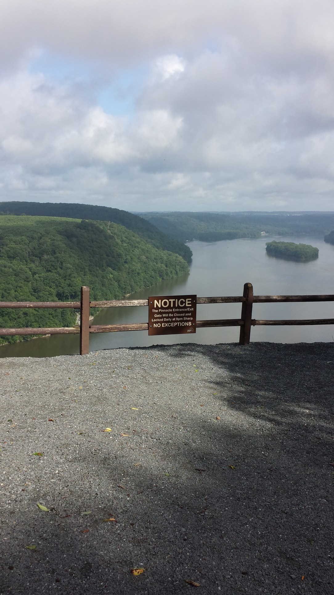
I’d read online that the trail was “strenuous” and “difficult” but wasn’t exactly prepared for that to be true; 9 in the morning and I was literally drenched in sweat. The trail descends from the overlook. It starts off normally but then starts making its way down the side of the valley. On the way back up you have to do some very basic rock climbing. The portion following the stream was likewise not as “trail-like” as I was expecting. There was a lot of hanging onto tree branches to avoid falling in the water and skipping on rocks over the stream. I have a nice pair of water proof hiking shoe which of course I was an idiot and decided not to wear that day. It would have made things a lot easier if walking through the stream would’ve been an option. A bathing suit would have been nice too (it was 88 all day) as there were several large pools in the stream it looked easy to take a dip into.

What I would think one of the more appealing things about the preserve for the non-hiker is that there’s virtually no way to get lost. Lancaster is a pretty populated places and say you do find yourself getting out of the painted trails and into the forest, you’re going to run into a the river or a road sooner or later.
After Kelly’s Run, I took a short nap in my car (true story: I was exhausted) and headed a couple miles up the road to Tucquan’s Glen, another nature preserve that’s actually connected to the Holtwood Reserve by the Conestoga Trail, a 63 mile trail through Lancaster county. I was aware that the Conestoga existed but not aware how easy it would have been to combine both of these hikes into one longer extended one (probably 4-5 hours).

This isn’t my first time at Tucquan Glenn. Compared to Kelly’s Run, it’s a walk in the park. The trail(s) also follow a creek that empties into the Susquehanna and there’s portions that are steep, but none of the climbing or scrambled necessary on my earlier hike. Again, I would have liked to have a bathing suit or shoes.
After Tucquan’s Glen, I was planning on driving up The River Road to stop for a few more hikes but ended missing a turn somewhere. I swear some days I’m morphing more and more into my father. I never used to have a problem using a GPS or asking directions but in the past year or so have started relying more and more on an innate “sense of direction” that’s clearly not there.

This portion of the Conestoga Valley would make an awesome daytrip or weekend destination and you could easily spend a day or two hiking in different locales or walk the Conestoga Trail which connects all of them on the Lancaster side.
If you’re looking to stay for the weekend, there are several campgrounds located right in the valley. If a hotel is more your thing, there are plenty along route 30 (on either side of the river) or just stay in Lancaster, where you could enjoy some good eating and a fun bar scene (and a really good beer tasting locale). Pequea Valley Campground is especially in the midst of everything located right between Tucquan Glen and some of the northern more hiking locales.
If you’re looking for other camping options try here or here.
The best way to explore all the different locations and take a nice scenic drive is the River Road which you could easily get on in Holtwood or directly off route 30 in Columbia. If you want a really scenic route and you’re coming down from Columbia, take a detour down River Hill Road to drive near the river and if from the south, Bridge Valley Road. The River Road takes an inland detour for a bit. If you’re more concerned with time then just stay on it.
Going north from Tuquan’s Glen are several other areas to stop and hike. Safe Harbor Park doesn’t have a ton of hiking but could be somewhere decent to stop for lunch and has a boat launch. A few miles up the road you’ll find the actual Turkey Hill (it’s a real place!) where there’s another Nature Preserve with some decent hiking trails. Now, the longer and more strenuous trails are located in the Tucquan Glen and Holtwood Preserves but I figured these were worth mentioned for those of you not inclined to really strain yourself.
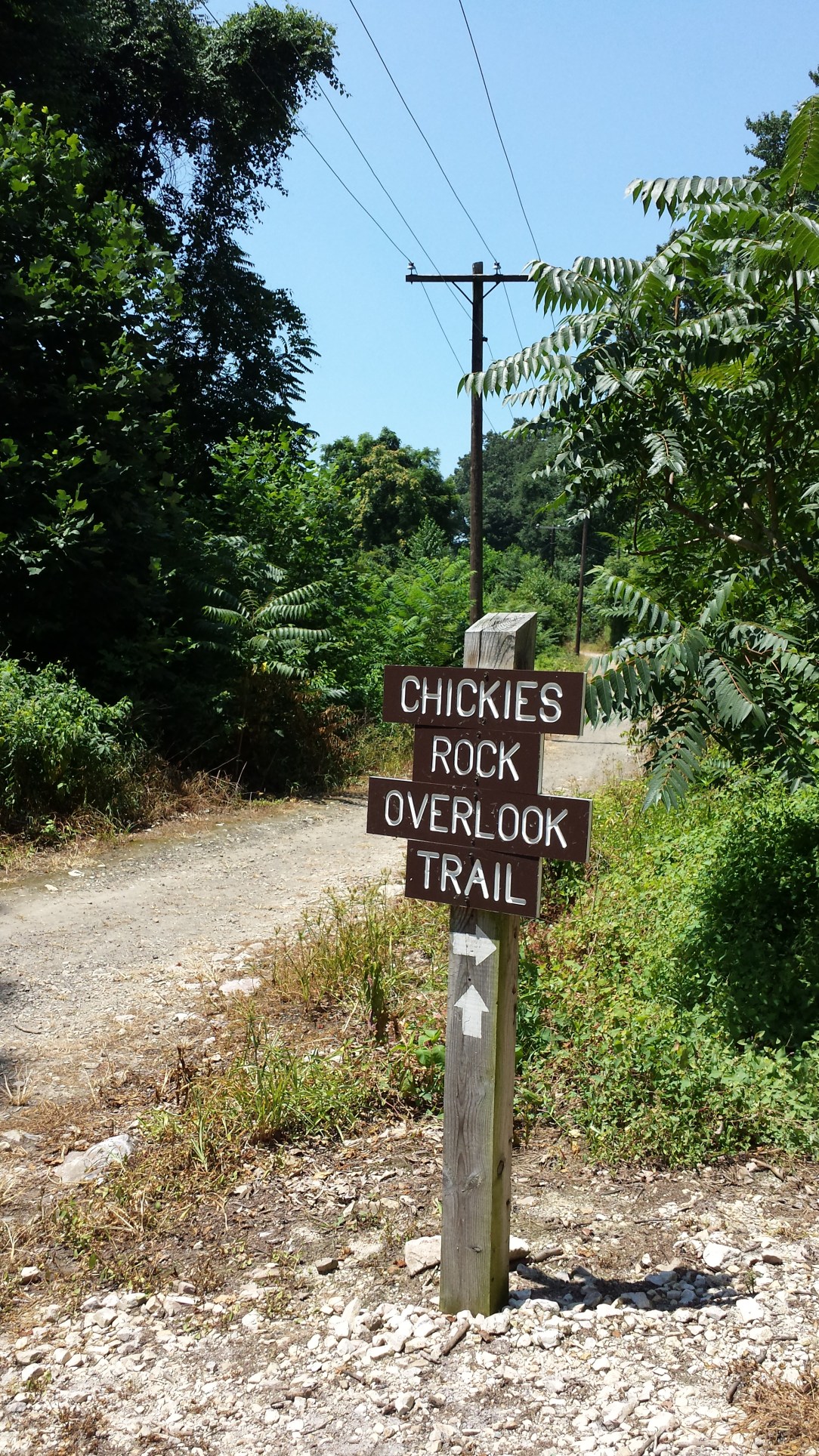
After my sixth sense of direction took my back to Lancaster, I was still feeling active so took route 30 out to the town of Columbia. There you’ll find Chickies Rock County Park. The main attraction here is Chickie’s Rock, a large outcropping of rock which hangs 100 feet above the river with an overlook on top.

There’s plenty of hiking trails here which are also mapped out on large displays near Chickie’s Rock overlook or the Breezy Point overlook a half mile down the road. The trail out to the overlook is pretty basic and only takes ten minutes, so if I hadn’t already hiked several miles I would’ve checked out the map they have with longer trail systems connecting Chickie’s Rock the Breezy Point Overlook (part of the same park system) or the River Front Park in nearby Marietta.

After Chickie’s Rock, I still had a small ounce of energy and decided to cross The Columbia Bridge into York County. Fun fact: the Columbia Bridge is the world’s largest free standing concrete viaduct and was once the sight of the world’s longest covered bridge (which was over a mile long). Now that that’s out of the way, I wanted to see if there was a version of the “River Road” on that side of the River. I didn’t make it far as after my fourth hike at The Highpoint Scenic Vista and Recreation area, I was ready for a nap (in my bed).

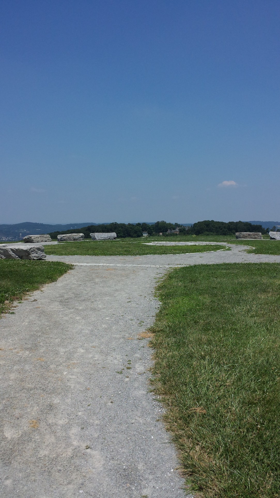
The Highpoint Scenic Vista and Recreation Area is located just south of the town of Wrightsville. It’s an 80 acre park with a half mile hiking trail to the summit which affords gorgeous views of the Susquehanna River Valley. At the top there’s a stone seating area to sit and hang out at if you so choose.

Check out the York Hiking Club homepage for ideas if you’d like to try the other hikes on the York side of the river. Aside from this short hike, I can’t be of too much service.
If an entire weekend of hiking isn’t what you had in mind, there’s several outfitters that could help with that. Chickie’s Rock Outfitters, located in Columbia’s River Park has canoes or kayaks for rent and can provide you with a guide if you book it in advance.

Shank’s Mare, located across the bridge from Columbia in Wrightsville, has kayak and paddleboard rentals, guided hikes and guided paddles. They also have an outdoor store and cross country ski gear, if you want to check out the valley during winter.


8 comments on “Weekend Trip Idea: Hiking and Camping the Susquehanna Valley”